
The city is located 45 meters above sea level and has 61.194 inhabitants (2013). The municipality is the most southern of the province of Granada; the Motril council is formed by Motril, which is the regional capital of the Costa Granada, El Varadero, Torrenueva, Carchuna, Calahonda, Puntalón, Playa Granada, Las Ventillas, La Perla, La Garnatilla, Los Tablones and La Chucha .
Points of Interest in Motril
Sugar Factories
- Acantilados de Calahonda, en el municipio de Motril.
- Nuestra Señora del Pilar
- Nuestra Señora de la Almudena
- Azucarera de San Luis
- Nuestra señora de Lourdes
- Nuestra Señora de la Cabeza (Alcoholera)
- Nuestra Señora de las Angustias (Fabriquilla)
- Azucarera de San Fernando (sólo queda la chimenea)
- Ingenio de San José, El Varadero (sólo queda una nave)

Religious Monuments in Motril
- Church: Iglesia Mayor de la Encarnación (1510-1514): the oldest monument of Motril;
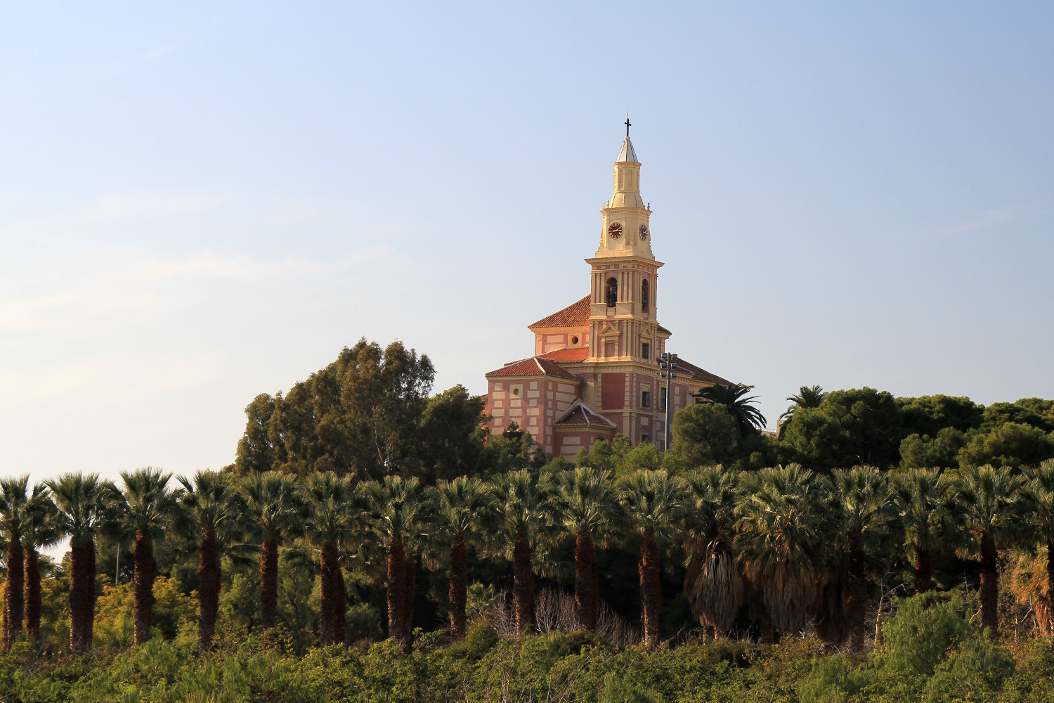
- Santuario de Nuestra Señora de la Cabeza known as "El Cerro de la Virgen" (1631)
- Church in Capuchinos: Iglesia de la Divina Pastora;
- Santuario de Nuestra Señora de la Victoria (1604);
- Chapel in protobaroque style: Ermita de la Virgen del Carmen (17th century)
- Church: Iglesia del Convento de las Nazarenas
- Chapel: Ermita de Nuestra Señora de las Angustias
- Chapel in baroque style: Ermita de San Antonio de Padua (17th century);
- Chapel: Ermita de San Nicolás
- Chapel: Ermita del Señor de Junes (>18th century);
- Capilla del Santo Rosario
Industrial Monuments in Motril
- La Fabriquilla
- Ntra. Señora del Pilar
- La Almudena
- The Alcoholera chimney
- The San Fernando chimney
- The industrial mills of the Camino de las Ventillas

Museums in Motril
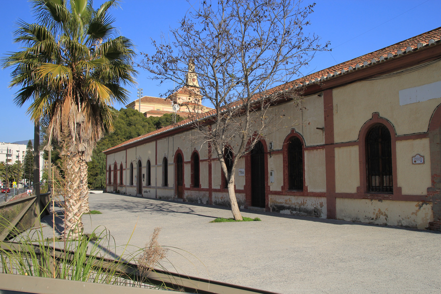
- Pre-Industrial Sugar Cane Museum; located in the entrance of the “Pueblos de America” Park;
- Sugar Cane Interpretation Centre;
- Gibraltarillo Museum;
- Mining Centre of the Cerro del Toro


Festivities in Motril
- January 13: vote of the City to commemorate the earthquake
- Easter: from Palm Sunday to Easter Sunday, processions of in total 13 brotherhoods.
- 3 May: Fiesta de las Cruces.
- July 16: Feast of the Virgin of Carmen, in the harbour.
- Week around August 15, festivities in honor of Nuestra Señora de la Cabeza, patron saint of the city.
- Second Sunday of October: fiestas in honor of Virgen de las Angustias, in the district of the same name.
- Third Sunday in October: fiestas in honor of the Divina Pastora, in the neighborhood of Capuchinos.

Civil Monuments in Motril
- Town Hall (1631);
- Casa de la Palma: the building was originally a sugar refinery and is located in the outskirts of Motril (16th century);
- Casa de la Condesa Torre Isabel: Señorial Andalusian-style house (17th century);
- Municipal Market
- Calderón de la Barca Theatre
- Carchuna Castle (1777);
- Bigotes Cave: in the cementery area of Calahonda, in the Camino del Puntal there is an Arab fortification;
- The Farillo of Calahonda: the tower was built to defend the coast from pirates and berbers

Nature in Motril
- The Charca de Suarez: located near to the Poniente Beach. These wetlands relate to the delta River Guadalfeo. In middle of the eighteenth century it covered over on thousand hectares now it is 14,65 ha. This area has an exceptional ecological value, with more than 200 species of vertebrates counted in the last census. It has become the most important wetland of the Tropical Coast of Granada. This area has been declared a Concluded Natural Reserve.
- The Gardens of the Casa de los Bates: These gardens are a representative example of typical gardens of Granada, with a series of characteristics that produce a marked balance between architecture, vegetation and landscape.
- The Pueblos de América Park: Is situated below the Ntra. Sra. de la Cabeza Sanctuary. The park is home to more than 50 exotic and subtropical plants brought over from different countries of the American Continent.
- The Tajo de los Vados: From a geological point of view it is a magnificent example of a karstic canyon excavated by the Guadalfeo River during the last hundred thousand years. Located on the north-west limit of the municipal district by the N-323 road to Granada, this area is ideal for rock climbing and is also important due to its great diversity of flora and fauna, with the presence of big vertebrates and many birds.
Photo Gallery of Motril


The Beaches of Motril


Basic Information Motril
Motril (36°44′43″N 3°31′14″O)
Altitude: 45 meters
Population: 61.194 (2013)
Distances:
Distance to Granada: 64 km
Distance to the beach: 3 km
Distance to Airport Malaga: 107 km
Distance to Airport Granada: 79 km
Touristic level: low - medium - high
Authentic level: low - medium - high
Facilities:
- Supermarkets: yes
- Banks: yes
- Restaurants: yes
- Bars: yes