
This village is located at 1082 meters above sea level and has 636 inhabitants (2013). It is located nearby the pass of La Ragua, the only connection between the north and south of the Sierra Nevada.
Laroles was a separate municipality together with Júbar until 1974, when it merged with Mairena and Picena in one municipality called Nevada. Since then it holds the capitalidad and is facilitating the council. The town is regional known for its chestnut, and fruits. As a part of its territory is in the Natural Park of Sierra Nevada, it is ideal for walks in these splendid surroundings.
Festivities in Laroles
- On the 6th of January, the procesión de los Manchos is held;
- In the weekend closest to the 20th of January the festival of the Moors and Christians is celebrated;
- On the 25th of April "San Marcos" is celebrated.
- The towns festivals are held every year on the first weekend of October in honor of the patron saint of the town, the Virgen del Rosario.

Points of Interesr in Laroles
- Church: Iglesia de Nuestra Sra. Del Rosario (16th century);
- Two washing sinks; (one below the playground and one at the end of la Calle Agua);
- Spring: Fuente de Mauricio;
- Viewpoint: "mirador del Mercaillo")
- La Fuente de la Virgen: fountain near the main square (1681)
- Ruins of Old Water Mills: take a part of the GR7 route in front of the kindergarten: Molino del Zocato (next to La Resbaladera), Molino del Estanque (GR-7 under the pool of Manolo), Molino del Atajo (below the natural pool), Molino de Paja Larga (at the right of the river Laroles), Molino del Marcos (left of the river Laroles), Molino de los Pericos (above Molino Zocato), Molino de Hervas (next to the viewpoint "mirador del Mercaillo"), Molino de Don Ceccilio (Calle Cubo), Molino de Antonio Hervas (above Molino de los Pericos)
- Recreation area in the direction of Mairena: Área Recreativa del Río Laroles. This place has several springs; on e even with furious water;
- Ruins of the castle of Júbar which are located on a small hill left of the road Laroles Mairena next to a big water deposit (8th century);
- Natural Park Sierra Nevada.
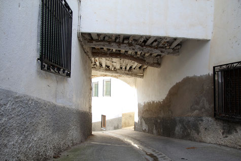
Photo Gallery of Laroles


Basic Information Laroles
Laroles (37°00′30″N
3°00′53″O)
Altitude: 1082 meters
Population: 636 (2013)
Distances:
Distance to Granada: 104 km
Distance to the beach: 46 km (Ladra)
Distance to the Airport of Malaga: 185 km
Distance to the Airport of Granada: 118 km
Touristic level: low - medium - high
Authentic level: low -medium - high
Facilities:
-
Supermarkets: yes
-
Banks: yes
-
Restaurants: yes
- Bars: yes