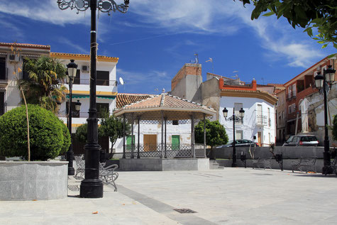
The town is located on a small slope next to the stream of Salar. The village is positioned near the A-92, which gives excellent access to nearby villages such as Loja or Huetor Tajar, or the cities of Granada, Malaga and Sevilla.
The town has an important olive tradition, although cereals, corn and asparagus are also produced. Archaeological findings show that this place has been inhabited since Neolithic times and later by the Romans, at least from the third and fourth centuries AD, as proved by the ruins of Gabino.
Its name comes from the Roman Sall and Latin sallere, which is derived from salebrus that might mean, rude, rough terrain of many canyons. The Islamic period has left deep traces in the town, whose life was always linked to Loja from which it was not separate until 1817. The Arabs called it Valle Hondo. It was conquered by Hernán Pérez del Pulgar and Osorio in 1486. It was repopulated and became a entailed estate. Later his descendants bought the jurisdiction (1583 and 1683) and had the lordship, a situation that has been maintained until the early twentieth century.


Points of Interest in Salar
- Church: Iglesia de Santa Ana (18th century);
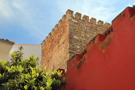
- Arabic Tower (14th century);
- Maison: Casa Palacio de los Pulgar (16th centruy).
Festivities in Salar
- The Candelaria is celebrated on the night from the 1st on the 2nd of February;
- On the 25th of April the festivities in honor of San Marcos are held;
- The fiestas in honor of the patrona Santa Ana are celebrated on the 26th of July;
- On the 16th of October the village fair is started;
- On the 1st of November Fiesta of the chestnuts is held.
Photo Gallery of Salar
Basic Information Salar
Salar (37°00′00″N 3°58′59″O)
Altitude: 544 meters
Population: 2735 inhabitants (2014)
Distances:
Distance to Granada: 50 km
Distance to the beach: 81 km (Malaga)
Distance to Airport Malaga: 93 km
Distance to Airport Granada: 38 km
Touristic level: low - medium - high
Authentic level: low - medium - high
Facilities:
- Supermarkets: yes
- Banks: yes
- Restaurants: yes
- Bars: yes


