
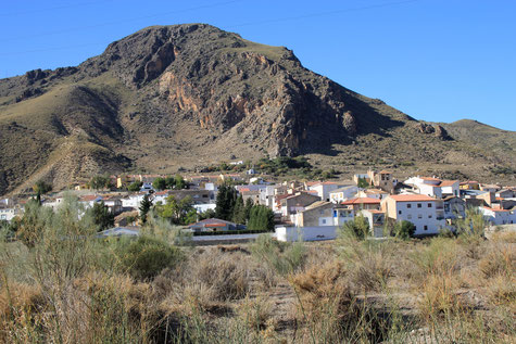
The village is located at 709 meters above sea level and has 529 inhabitants (2014). Alicún Ortega has been inhabited since prehistoric times. Important archaeological remains of Neolithic and Iberian period have been found . During the Roman period the city appears as "Acatucci" in the itinerary of Arles (France). In the village you can visit a beautiful church of the XVI century quadrangular, and although there are not many monuments, Alicún de Ortega is an especially attractive place to enjoy the beautiful surroundings: walks on the shore of the Guadahortuna, routes through the forest and beautiful landscapes give this small town a calm character.
Points of Interest in Alicún de Ortega
- Chapel: "Ermita San Roque";
- Remains of a Castle;
- Church: "Iglesia parroquial de Nuestra Señora de la Anunciación" (1595):
- River Guadahortuna.
Festivities in Alicún de Ortega
- On the 12th and 13th of May are the fiestas celebrated in honor of the patron Fatima;
- From the 15th until the 18th of Augustus the festival in honor of San Roque is celebrated.
Basic Information Alicún de Ortega
Alicún de Ortega (37°36′29″N 3°08′15″O)
Altitude: 709 meters
Population: 529 inhabitants (2014)
Distances:
Distance to Granada: 101 km
Distance to the beach: 155 km (Almeria)
Distance to Airport Malaga: 235 km
Distance to Airport Granada: 115 km
Touristic level: low - medium - high
Authentic level: low - medium - high
Facilities:
- Supermarkets: yes
- Banks: yes
- Restaurants: yes
- Bars: yes