
The village is close situated to the highway between Malaga and Granada and is located in a beautiul landscape. Its relief evenly leads to outstanding ravines like Arroyo de la Verdeja, la Torre and los Pinares. Within the town itself, there are several streams (now channeled) that cross the village before they join the river Genil.
The lanscape is mainly agricultural with riverside vegetation, poplars, Olmos and twigs. The village was formed initially by numerous mills and farmhouses. While the settlements in this land according the archaeological remains start with Neanderthals in the Upper Paleolithic 150,000 years ago and continue with the Iberians, Phoenicians, Romans, Visigoths and finally the Muslims.
The village was situated in a zone that was maintained for more than two centuries as a border between the Kingdom of Granada and the Christian kingdom of Castile. It was the "last frontier of al-Andalus", so the people and land that have an endless source of the legends, the stories and battles.
Points of Interest Villanueva Mesía
- Damm;
- Museum Tahona o Pósito which was an old bakery situated next to the town hall (17th century). In the museum is an exibition about the history of the town and also about the working of a flour mill;
- Stream: Arroyo de los Pinares;
- Irrigation Systems: Sistemas de Riego Andalusí;
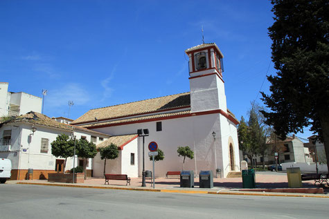
- Church: Iglesia Parroquial de Ntra. Sra. la Aurora (mudéjar style);
- Local Swimming Pool;
- There are more than 20 mountain bike routes, and also several hiking routes.
Festivities in Villanueva Mesía
- San Sebastián Pattern Day is celebrated on the 20th of January;
- In the night from the 1st on the 2nd of February the day of the Candelaria is celbrated with fires in the streets of the village;
- San Marcos is celebrated on the 25th of April (picnic in the fields);
- Festivities in honor of Santiago Apostle are celebrated from the 24th until the 26th of July;
- A Festival and a Cattle Fair is held from the 14th until the 19th of October.

Photo Gallery of Villanueva Mesía


Basic Information Villanueva Mesía
Villanueva Mesía (37°12′53″N 4°00′46″O)
Altitude: 489 meters
Population: 2045 inhabitants (2014)
Distances:
Distance to Granada: 41 km
Distance to the beach: 90 km (Malaga)
Distance to Airport Malaga: 102 km
Distance to Airport Granada: 29 km
Touristic level: low - medium - high
Authentic level: low - medium - high
Facilities:
- Supermarkets: yes
- Banks: yes
- Restaurants: yes
- Bars: yes