
Algarinejo is a town whose origins dates back to the Paleolithic, regarding the rests they found nearby. The Romans were also presents. It were the Arabics who gave the town its name ("al-Garin" which means "cave" in Arabic).
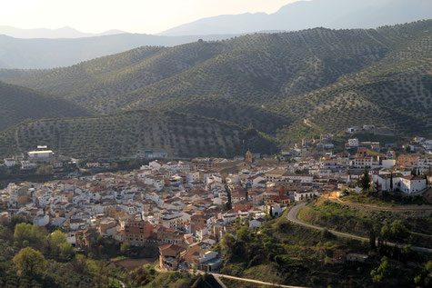
In this municipality you can encounter rivers and streams, mountains, spectacular canyons and waterfalls and large scenic overlooks on the inner Andalusia.
In this town you can recover the old memory of people and enjoy the slow rhythm, the tranquility of rural life, the quality of traditional food products, the warmth and hospitality of its people. Algarinejo is offering a full range of services and accommodations. There is a Network of Footpaths present to foster the tourist a pleasant and memorable stay.
Festivities in Algarinejo
- On the night before the 2nd of February the Candelaria is celebrated which several fires in the town;
- The pelgrimage of San Marcos is held on the 25th of April;
- On the 3rd of May the day of the Cross is celebrated;
- The pelgrimage of San Isidro is celebrated on the 15th of May near the Puente de 7 Ojos;
- The first weekend after Corpus Cristhi the fair of the district Barrio de Redonda is celebrated;
- The fiesta de San Juan is celebrated on the 24th of June and in Fuentes de Cesna they celebrate their fair;
- On the 24th until the 26th of July or the closest weekend a small fair is celebrated in honor of Santa Ana;
- In Fuente de Cesna the Fiesta of the emigrant is held on the 15th of August;
- The big fair is celbrated in the last week of August;
- In Fuente de Cesna the fair is held from the 27th until the 30th of September;
- On the 8th of December the fiestas of Inmculada is celebrated in honor of the patrona La Viña.

Points of Interest in Algarinejo
- Cesna Castle
- Cesna Park (abandoned village Fuente de Cesna);
- The church of Santa Maria La Mayor (1779);
- The Chapel of Santa Cristo (1730);
- The Factory (old abandoned liquor factory, 17th century);
- The Paris House;
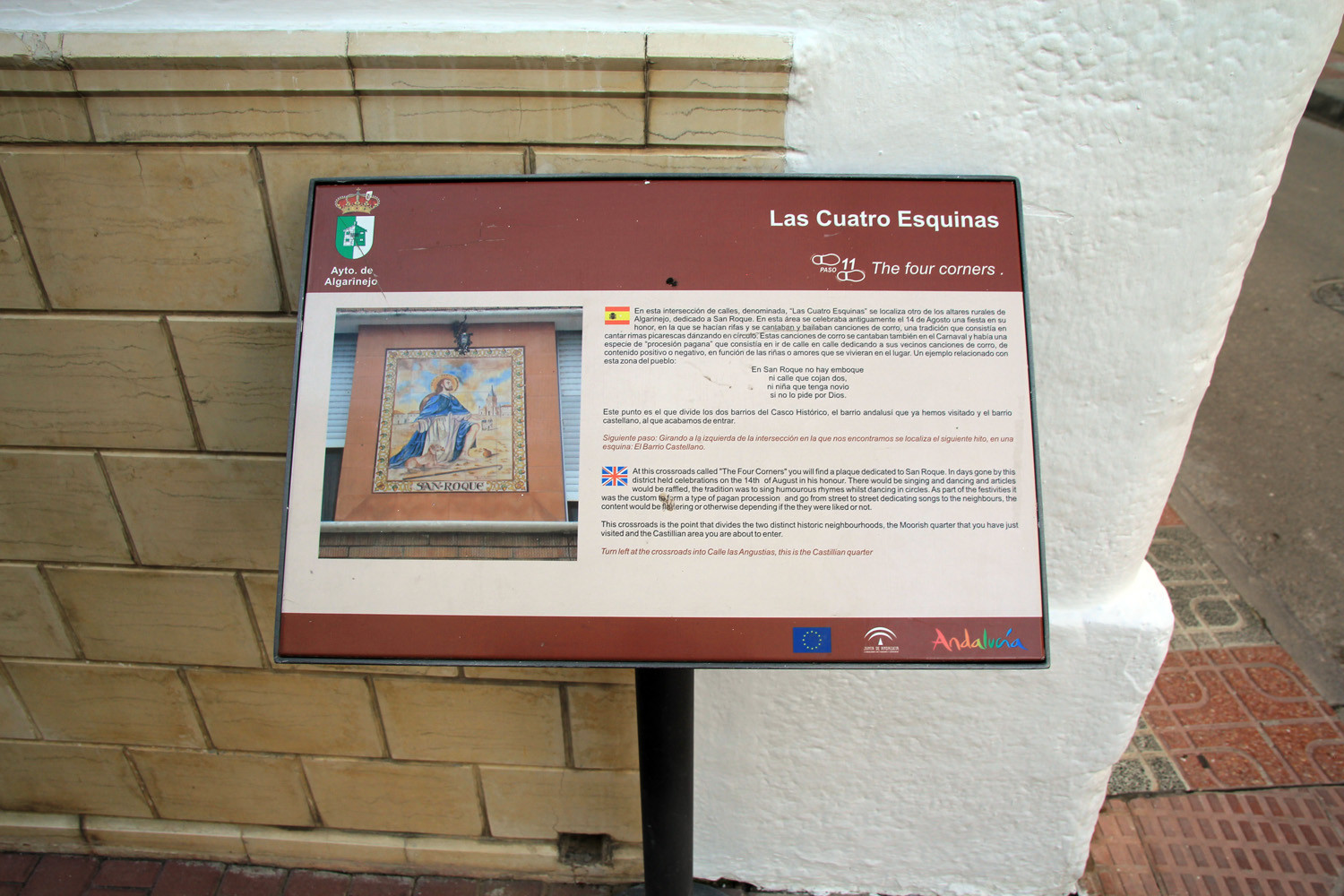
- The Castilian District;
- Watermills;
- Puente de los Morales (old bridge);
- Puente Hundido (old bridge);
- Puente de los 7 Ojos;
- Noria de la Gancha;
- Remains of Palacio de los Córdova;
- The tower of Pesquera;
- Old mining hamlet of Sierra Ojete;
- Village of Peñom (abonded village);
- The hamlet of Fuente Viejas;
- Mountain range Las Chanzas;
- Ravine Cerradura del Pesquera;
- Waterfalls: Waterfall Aroyo Seco, Las Llanadas, Waterfalls Nueva España, waterfall Turca, waterfall El Chite, waterfall La Viña;
- Recreational area Nueva España;
- Picnic area Pesquera.

Photo Gallery of Algarinejo


Basic Information Algarinejo
Algarinejo (37°19′30″N 4°09′31″O)
Altitude: 608 meters
Population: 2875 inhabitants (2014)
Distances:
Distance to Granada: 76 km
Distance to the beach: 100 km (Malaga)
Distance to Airport Malaga: 112 km
Distance to Airport Granada: 64 km
Touristic level: low - medium - high
Authentic level: low - medium - high
Facilities:
- Supermarkets: yes
- Banks: yes
- Restaurants: yes
- Bars: yes